
GIS and 3D Inspections for Better Asset Decisions
by Aaron Skeates-Udy | April 30, 2026
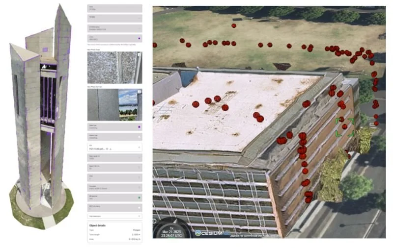
At Ironbridge Engineering we investigate and examine tools that improve decision making on large asset portfolios. GIS paired with 3D inspections (LiDAR, photogrammetry, drones and scan-to-BIM) lifts visibility and accessibility of data well beyond excel records or spot checks.
What is possible?
High-resolution 3D models create digital twins that map critical facade, structural or height safety element across a portfolio of assets. Defects and inspection notes appear pinpointed in space, layered with usage history, site notes and risk scores. Teams can run scenario models, quantity take off, predict failures and generate portfolio dashboards for capex prioritisation, all without repeated site visits.
What is practical?
The hardware and cloud processing costs keep falling, yet full capture across thousands of assets still carries real expense in data storage, integration and skills. Most operators start with targeted scans on high-value or high-risk structures, then scale. Hybrid approaches are common, drone overflights plus selective detailed scans, deliver measurable gains in safety, reduced downtime and smarter maintenance budgets while staying within typical project budgets.
If you’d like to discuss the appropriate approach and balance for your assets, please contact the Ironbridge Engineering team.